

As part of our project Mapping the Social City, we are asking: How can social maps and mapping tools offer new insights on peoples’ experiences in urban neighbourhoods?
Have a look at some of the great examples we’ve found so far, from around the world, showing how maps and mapping can contribute to innovative placemaking in cities. Are you involved with or know about any other examples? We want to hear from you!
Send your contributions to saskia.baard@social-life.co or find more details here: Mapping the Social City call for contributions.
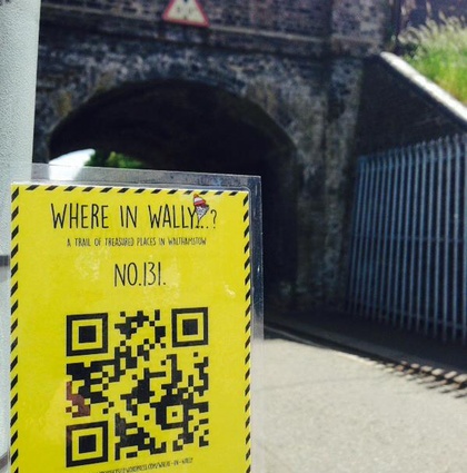
In Walthamstow, the UK, the Where in Wally project investigated community assets in Walthamstow through participatory mapping. Community members were asked to contribute stories about treasured, publicly accessible spaces in the area. These spaces were both mapped online and tagged physically.
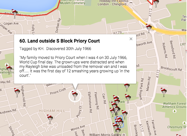
Source: https://architectse17.wordpress.com/where-in-wally/
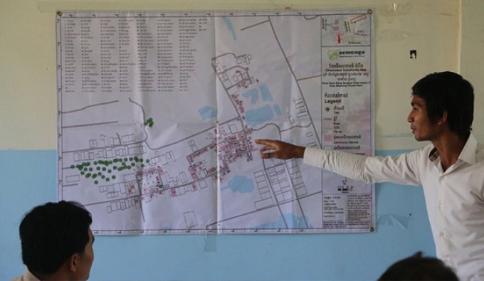
In Phnom Penh, Cambodia, community mapping is used by Sahmakum Teang Tnaut, a Camobodian Urban NGO, to strengthen the position of communities under threat of eviction. Participatory approaches and mapping are used to gather data around urban issues for advocacy and to influence policy around infrastructure upgrading, evictions, and displacement of the urban poor in Phnom Penh. The images below are from a community training event to for basic map-sketching skills and understanding the value of community mapping. The NGO engages in enumeration and mapping activities with communities who are often excluded from formal / government census and mapping activities.
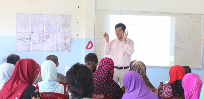
Source: http://teangtnaut.org/the-community-enumeration-and-mapping-workshop/
In Seoul, South Korea, the Community Mapping Centre uses local knowledge to make community maps to encourage sharing between people and encourage participation in urban issues with a view to solve problems within the city.
The map below visualises the locations and information about various social enterprises, cooperatives, other small enterprises, and supporting organizations in Seoul.
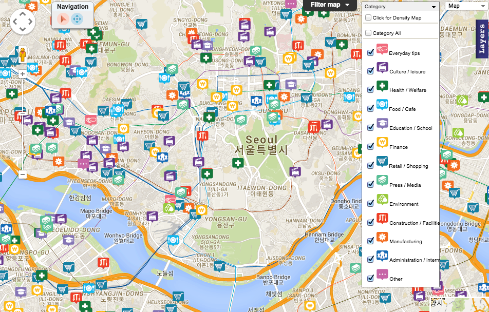
Source: http://www.mapplerk.com/semap/
In San Francisco, the USA, the Anti-Eviction Mapping Project documents urban change by using data visualisation and storytelling to document displacement and gentrification across the city. The project explores the (uneven) relationships between the tech industry, city authorities, and residents living in the city.
The map below shows no-fault evictions in the city over time (1997 – 2004). The project also uses mapping to document stories or observations from people who have experienced displacement like their crowdmap.
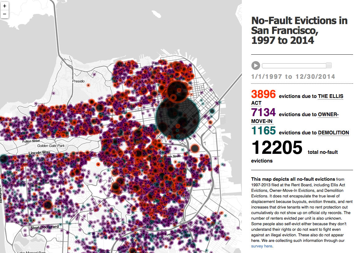
Source: http://www.antievictionmappingproject.net/combined.html
Mapping the Social City is a joint project between Social Life and the Social Innovation Exchange (SIX).
Are you involved with or know about any other examples? We want to hear from you!