Social Life and the Social Innovation Exchange (SIX) are excited to open a call for contributions for a new crowd-sourced mapping project, Mapping the Social City, the first initiative in our new, joint Cities Insights Hub.
We’re asking: How can social maps and mapping tools offer new insights on peoples’ experiences in urban neighbourhoods?
We want to understand what life is like beyond the physical infrastructure of cities: how can maps help us understand neighbourliness, belonging, isolation, adaptability, social and cultural life, safety, and wellbeing? What can tools like this offer policymakers and practitioners to create innovative placemaking in cities?
Increasing access to open data sets means that we are seeing more and more images and maps visualising quantitative information. Many of these are based on economic or environmental statistics, often about on the built environment, pollution, transport, or energy networks. But these often ignore people and their everyday lives; we don’t see many maps that try to really understand everyday experiences and perceptions at a local level in cities.
A review panel will evaluate the contributions, and a final selection will be published on the SIX and Social Life websites, both with a global reach - SIX’s membership consists of over 7000 members from around the world.
Work submitted may also be featured at the SIX Summer School in Mumbai in November 2015 with the theme of “Next stop: participation city! How can new ways of connecting make cities better for all?”.
Mapping the Social City will collaborate with community groups, city leaders, researchers, and social innovators around the world to develop new insights and methods to understand the social life of cities and to accelerate urban social innovation.
We want to showcase interesting examples to inspire and challenge, as well as share methods, tools, and approaches that can be adapted for new contexts. We are looking for case studies and examples to share with SIX members and to kickstart content for our new Cities Insights Hub.
Our approach is to think about cities from the ground up. Most work on cities takes a top-down perspective on how to tackle social challenges. We focus on everyday experiences and local places to find new perspectives on urban social life and social innovation.
We want to reach out to different networks to gather contributions from a wide range of fields and sectors.
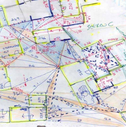
We want to find a range of examples including digital tools and maps; visualisations (these could be computer generated or hand drawn); documentation about people’s experiences. We would love to be sent striking visualisations (low tech or high tech), but we’re also interested in the tools that were used to make the visualisation, how they were made and how the data was gathered.
The call for contributions is open until 20 July 2015. All contributions will be credited.
1 Send us your examples
We are looking for any innovative examples of mapping that helps us to better understand social dynamics within the city.
2 Profile your organisation or work
We would also love to hear from you if you have first-hand experience producing participatory maps or using innovative participatory mapping methods. We would welcome contributions in the form of case studies, articles, or blogs.
We are also interested in hearing about what doesn’t work!
3 Format for contributions
Please send us an email with map, your visualisation, or case study, article, or short essay documenting the example, including why and how it was made, why you think it’s interesting and important and what the impact is.
Inspiration
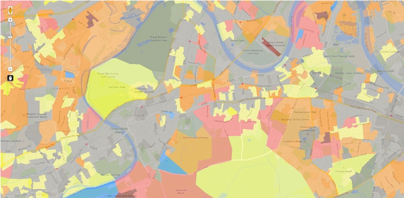
Social Life’s Neighbourhood Big Data tool
A mapping tool that looks at how people feel about where they live, that maps data about belonging and neighbourliness in local communities in the UK.
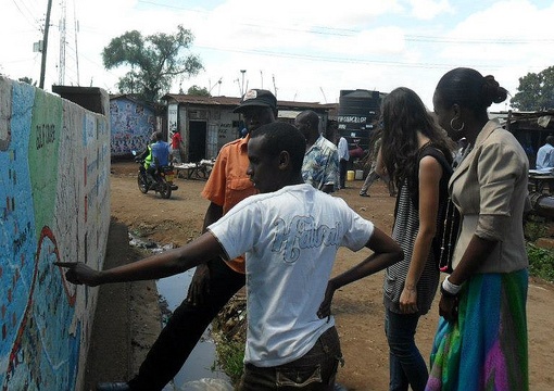
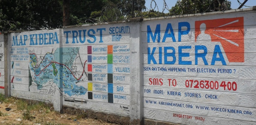
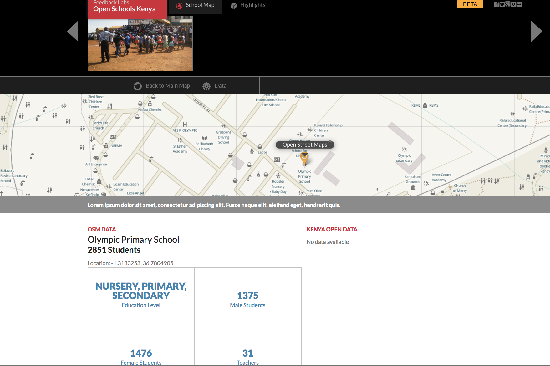
In Kibera, Nairobi, citizen mapping is used to put marginalised communities on the map and amplify the voice of the community in the Map Kibera project.
In Peckham Rye in London, Commonplace was used to collect and map local people’s views and ideas for changes and improvements to the area around Peckham Rye Station.
In South Africa, participatory community mapping is used in the process of ‘re-blocking’, an approach to improve layout, increase service delivery, and improve safety in informal settlements.

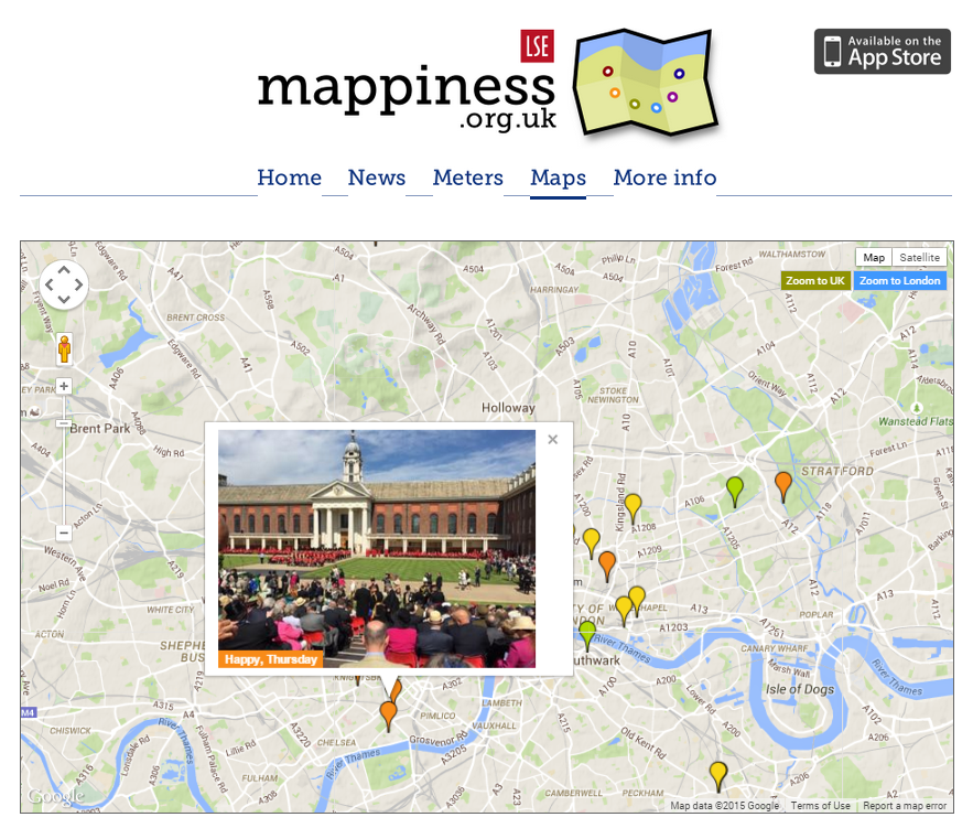
Mappiness is an app used for research to document and analyse the link between people’s happiness and their local environment.
Please send any contributions or questions to Saskia Baard at Social Life via email: Saskia.Baard@social-life.co.
Social Life and the SIX are launching the Cities Insight Hub in 2015. The Hub will curate and share innovative methods for understanding the social life of cities, starting with a compilation of social mapping tools and collaborative research methods that offer new insights on urban neighbourhoods and urban innovation. The Cities Insights Hub will also bring together people and organisations around the world who are working to improve peoples’ lives by designing cities for people.
Over the last 8 years, SIX has inspired, connected and supported thousands of individuals and organisations, across sectors and industries, to build the field of social innovation globally. We bring together people from diverse perspectives to exchange and share how to accelerate social innovation. By connecting innovators, and developing, curating and disseminating ideas and practical examples of social innovation, SIX enables its global community to learn from each other, building the capacities of our members to become better innovators.
Social Life’s work is about the relationship between people and places. We specialises in research and community projects exploring how people are affected by changes in the built environment.
We believe that creating places that support local people, which are socially sustainable, matters as much as creating places that are economically and environmentally sustainable. We bring these insights to the process of planning, designing and managing places by working with communities, built environment professionals, public agencies and governments, in the UK and internationally.
We don’t see many maps that try to really understand everyday experiences and perceptions at the local level in cities.