

Mapping the Social City is a joint project from Social Life and the Social Innovation Exchange (SIX).
We wanted to understand what life is like beyond the physical infrastructure of cities: how can maps help us understand neighbourliness, belonging, isolation, adaptability, social and cultural life, safety, and wellbeing? We will explore how tools like this can help policymakers, practitioners and local communities create innovative placemaking in cities
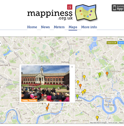
Increasing access to open data means that we are seeing more and more images and maps visualising quantitative information, but this tends to focus on the built environment, pollution, transport, or energy networks. Examples of maps that focus on everyday experiences and perceptions at a local level in cities are rare.
The Atlas of Social Maps is the first output from Social Life and SIX's Mapping the Social City project. The Atlas is an evolving updateable resource profiling over 50 participatory maps.
Read our blogs about the Atlas, and what we learnt from making it.