

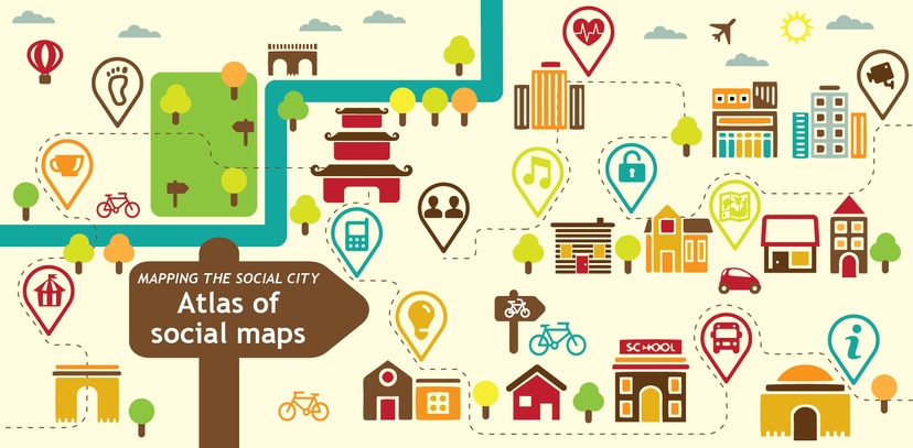
Through our Mapping the Social City project, Social Life and SIX have been exploring how maps and mapping tools can help us understand local places and people’s everyday experiences, to help us find new perspectives on urban social life and social innovation in cities. Following our call for examples of participatory maps earlier in the year, we have compiled the Atlas of Social Maps to bring together and share interesting examples of maps and useful mapping tools and methods. This blogpost introduces the Atlas of Social Maps, and gives some background on why we have created this resource.
Mapping the Social City looked internationally for tools and approaches, from different fields and sectors. We discovered a combination of online and offline maps, mostly place based. The maps were categorised according to five focus areas: activism, conviviality, networks, everyday life, and urban planning. The maps all aimed to understand an aspect of social experiences in an urban context. Many of these maps weren’t used in isolation, but as part of wider initiatives.
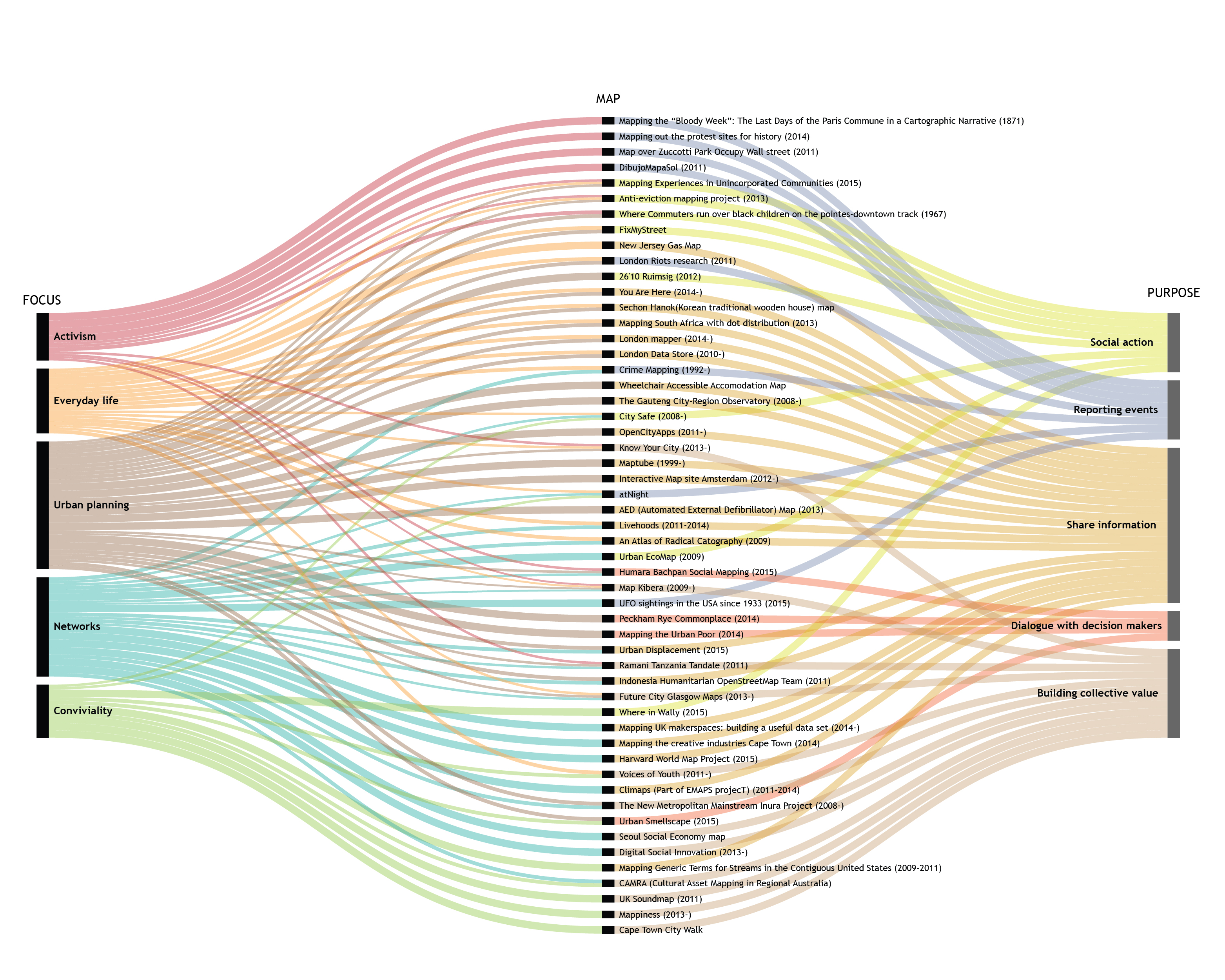
Alluvial Diagram showing the maps in the Atlas of social maps. Click here for a larger version. Made with Raw, software developed by Density Design Research Lab, Politecnico di Milano. www.raw.densitydesign.org
Many mapping tools and outputs focus on the physical city – for example the built environment or transport and energy networks. However mapping can be a powerful way to unearth different perspectives about how people feel about living in cities, and how their perceptions shape city life. Examples of these types of approaches are less well known.
When we set up this project we our interest was in going beyond the physical city of architecture, transport, and technical infrastructure. We wanted to delve deeper into social experiences, particularly the small-scale and seemingly mundane aspects of urban life. This approach can give voice to those whose views are often left out of planning and service design. Here, important sources of insight and inspiration for social innovators can be found.
Our Atlas uncovered a wide range of different maps, ranging from maps created by activists, artists, and local grassroot organisations, aiming to empower and give voice to local people, to more formal, institutionalised maps created by authorities used for urban planning and communication. We consider social maps to be maps and visualisations that illustrate more than only geographical features or physical infrastructure, but to be maps that tell us something about people’s connections, stories, and experiences – either relating to each other or to a specific environment.
The Atlas allows us to explore and compare examples of social maps mapping tools that gives us insights into urban environments from a people perspective. These maps and tools can help us to make maps that matter for residents, bringing people into the process of mapmaking, and applying these processes and outcomes as a means for activism, conviviality, networking, and urban planning.
You can access, explore, and share the Social Mapping Atlas here.
You can read more about the uses and usefulness of these maps on our blogpost "Mapping the Social City: what we found". Read more about the goals and methods used in these maps in an older post here by María de los Ángeles Briones a PhD student at the Density Design Research Lab at the Politecnico di Milano. We are grateful to María for her general support in this project and leading the development of the categories used to analyse the maps.
If you would like to suggest an update or contribute to the Atlas, please email saskia.baard@social-life.co